Sacramento Valley, already deluged, braces for more floods
By Julie Cart and Alastair Bland, CalMatters.org
January 4, 2023
In summary
Storms have already tested a region at high risk of flooding. One report says the Central Valley needs $30 billion in improvements over 30 years.
Raising questions about whether California’s elaborate system of flood protections will hold, another dangerous storm is barreling toward the Sacramento Valley, where rains already punched through some levees and floods killed at least one person.
The storms have tested the flood-prevention infrastructure across the region, which sits at the confluence of two major rivers and bears the brunt of heavy rains. “It’s a bathtub, basically,” said Beth Salyers, deputy district engineer for the federal Army Corps of Engineers in Sacramento.
In the Central Valley, an estimated 1.3 million people and $223 billion worth of property are protected by the state-federal systems of levees, dams and other structures.
California spends $48 million annually for operating flood protections but needs much more — “$3.2 billion over the next five years of implementation,” according to the state’s Central Valley Flood Protection Plan, a document produced in 2012 and updated last month. Of that, the state’s responsibility ranges from $1.8 billion to $2.8 billion.
An estimated $25 to $30 billion in funding over 30 years could help the state “avoid the astronomical cost of catastrophic flooding in the Central Valley estimated to be as high as $1 trillion, in addition to an incalculable toll on lives and public well-being,” the plan says.
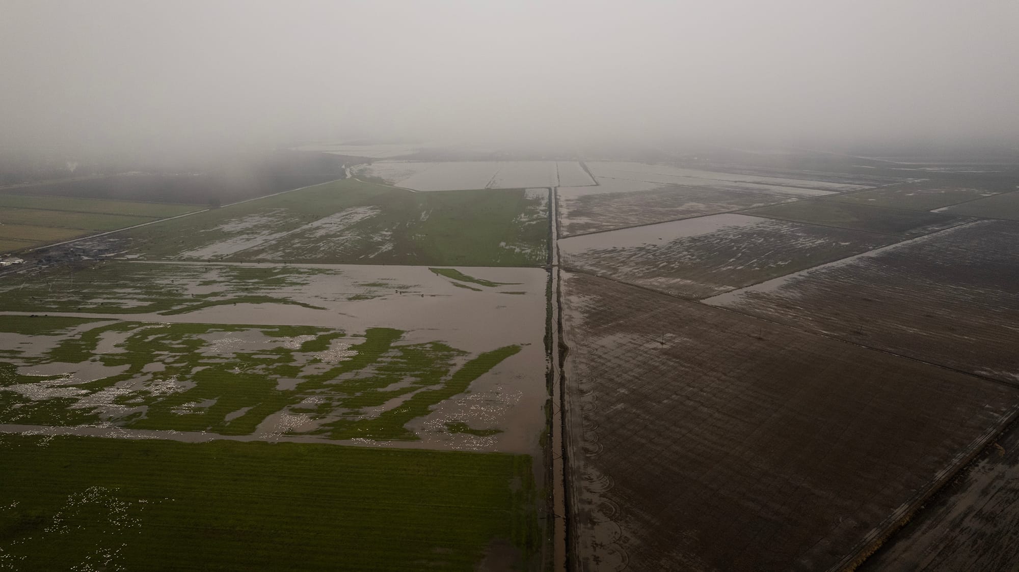
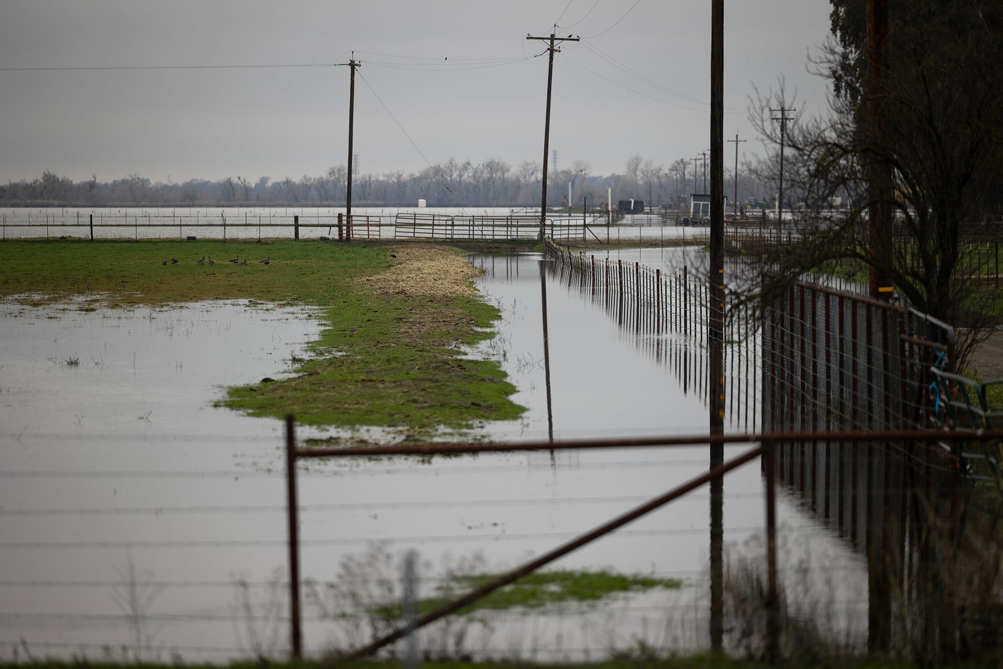
So far, the storms have been severe but not catastrophic: The New Year’s Eve storm “stalled out” over the watershed of the Cosumnes River. Portions of privately owned levees on the river gave way, flooding nearby areas. The levees, constructed to reclaim the land for agriculture, are generally rated only to handle a 10-year flood, according to Sacramento County officials. The breeching of the levees shut down Highway 99 and stranded motorists.
But the region’s two major reservoirs held, and the Sacramento and American rivers did not experience major floods.
“The investments we’ve made to the flood system have absolutely helped,” said Gary Lippner, the Department of Water Resources’ deputy director of flood management and dam safety. “At the larger scale, our system is much more ready for high-water events.”
The state’s capital city was built in a floodplain and requires an extensive system of levees to protect it. Federal, state and local authorities are in the midst of upgrading those defenses, particularly in the Sacramento region, where multi-year, multi-billion-dollar projects are underway.
Major improvements have been made in the region and more are underway, thanks to about $1.8 billion in state and federal funds. The Army Corps and state have been upgrading about 45 miles of levees over a 5-year period, and work on the final 2.8 miles is scheduled to begin in the spring.
Among the structural upgrades are raising levee heights, boring as deep as 150 feet to reinforce levees to prevent seepage and piling rocks on riverbanks to reduce erosion.
“All of the work that we’ve done along the American and Sacramento Rivers are helping the current situation. We are not seeing flooding off these rivers,” Salyers said. The completed projects are now weather-tested, she said, and “performing the way we wanted them to.”
“All of the work that we’ve done along the American and Sacramento Rivers are helping the current situation. We are not seeing flooding off these rivers.”
Beth Salyers, Army Corps of Engineers
Beth Salyers, Army Corps of Engineers
State officials expressed confidence that the Central Valley’s levees and bypasses will contain the deluges coming this week.
“We do have a significant amount of capacity within the bypass system in that 1,600 miles of levee, and I don’t anticipate … there to be emergency management needs,” Lippner said.
But every flood-protection system has its limits.
Last year, Daniel Swain, a UCLA climate scientist who studies extreme weather events, warned in a scientific report that a major atmospheric river-type flood event could, in the worst of scenarios, cause $1 trillion in damage in the Central Valley.
Swain and his coauthor, Xingying Huang of the National Center for Atmospheric Research, warned that a storm could station itself over the state for weeks on end, producing three feet or more of rain, inundating major population centers and disrupting economic activity.
Michael Anderson, a climatologist with the California Department of Water Resources, noted that impacts from the upcoming storm system could escalate to a “worst-case scenario” if it “becomes an unrelenting series of storms.”
Forecasters are warning residents in the Sacramento region and the Bay Area to prepare today for yet another assault, this time from a “bomb cyclone” spinning in the Pacific that will not make landfall but will amplify rain, wind and frigid temperatures along the coast and foothills.
Forecasters are expecting more atmospheric rivers — the powerful streams of tropical moisture that deliver most of California’s winter rainfall.
“This will be a high-impact event, a pretty intense storm Wednesday night,” Swain said. “The stage is set for something potentially big to happen if the model trends toward the higher end.
“There will be some flooding, it’s a question of how much.”
‘We like rain in California, but we love snow’
In the mountains that supply these reservoirs, snow levels are now above average. The Department of Water Resources’ first snow survey of the season took place on Tuesday at Phillips Station, in the Sierra Nevada, west of Lake Tahoe. Scientists measured 55.5 inches of snow and a snow water equivalent of 17.5 inches. That’s 177% of average for this location. Statewide, snowpack levels are at 174% of average for that date.
Statewide, this is the best start to the snow season in 40 years, according to Department of Water Resources officials.
It would be hasty, though, to assume the ongoing storms and wet forecast mark an end to the drought. In 2021, record rains and heavy snowfall arrived between October and December. Then, California experienced its driest January-through-March — typically the state’s wettest months — in recorded history.
Experts say consecutive storms are made more dangerous by an already-soaked landscape’s inability to absorb more water. In addition to creating swollen creeks and mudslides, incessant rain reduces soils’ ability to hold vegetation, and California’s millions of drought-ravaged trees can easily fall over. Areas with wildfire burn scars are at risk of flash-flooding, officials said.
“The big wild card will be what happens next week,” Swain said. “There’s a wide range of uncertainty. If one or two of those events occur next week, then all bets are off.”
Although rain has fallen on Southern California, it has largely been spared. The worst of the coming storm will mostly stop at the northern edge of Los Angeles County, Swain said.
!function(){"use strict";window.addEventListener("message",(function(e){if(void 0!==e.data["datawrapper-height"]){var t=document.querySelectorAll("iframe");for(var a in e.data["datawrapper-height"])for(var r=0;r<t.length;r++){if(t[r].contentWindow===e.source)t[r].style.height=e.data["datawrapper-height"][a]+"px"}}}))}();
Jane Dolan, president of the Central Valley Flood Protection Board, advised residents throughout the Central Valley to stay on guard and take warnings and advisories to heart. “If you’re at an elevation below 200 feet, near a levee that’s older than you, pay attention to alerts,” she said.
The state has established emergency shelters in Sacramento and San Mateo Counties and has stockpiled 3.7 million sandbags.
Some experts think the flooding from the incoming storms could be tempered by the fact that the developing system is relatively cold. This will translate into more snow and less rain, at least at high elevations.
Last weekend’s storm was relatively warm and produced rainfall at high elevations, where the liquid water fell on several feet of snow, melting it and magnifying the runoff into streams and rivers.
But today’s storm is colder. That means more precipitation will probably fall as snow.
“We like rain in California, but we love snow,” said John Abatzoglou, a UC Merced professor of climatology. He said that over the weekend, rain fell at elevations of 8,000 feet or more and may have worsened lowland flooding.
Anderson said today’s storm will probably produce rainfall no higher than 5,000 to 6,000 feet and snowfall above that, minimizing rain-on-snow flooding impacts.
“This will be a good mix of both heavy rain at the lower elevations, snowfall at the higher elevations,” he said.
'Need to act with renewed urgency'
Climate modeling suggests that global warming is likely to make storms larger, stronger and more intense. It will also cause more precipitation to fall in liquid form. This translates into worsening floods as the Central Valley’s system of levees, weirs and bypasses ages past its prime.
The flood board updated Central Valley Flood Protection Plan, released last month, warns of “1,000-year storm events … and the need to act with renewed urgency and purpose before the next large flood event occurs in the Central Valley.”
The plan calls on nature-based solutions, like restored floodplains, and infrastructural improvements, like fortified levees near urban areas, to help mitigate the impacts of higher-energy storm systems expected as a result of the warming climate.
Most of the historic floodplains along the Central Valley’s rivers have been separated from the water by levees. Scientists now agree that restoring floodplains can be an effective flood control strategy by allowing surging rivers to spill their banks and shed their energy on unpopulated flatlands, rather than bursting through aging levees surrounding populated areas. Floodplains also provide fish and wildlife habitat, and they can serve as groundwater percolation beds.
When a lot of rain falls in a short span of time, it’s difficult for many regions to handle, especially low-lying coastal areas. Downtown San Francisco was drenched with nearly six inches of rain over the weekend, and incoming high tide.
“It takes a lot of time for that water to find a way out,” said Mark Dickman, associate director for data at the U.S. Geological Survey in Sacramento. “There’s just nowhere for it to go.”
It’s a persistent and familiar challenge: What to do with water when there’s too much and how to manage when there isn’t enough.
“We are built for this,” said Jeffrey Mount, a water specialist at the Public Policy Institute of California. “We built the system around the notion that we get occasionally wet years and mostly dry years. But, unlike the Colorado River Basin, where they can capture and control four years of runoff, we are full after one year. Our ability to store surface water is limited.
“It is the nature of a semi-arid climate that we will see this whiplash — the three driest years on record and, if this year continues, we will get a year like 2017, the wettest on record. We have not figured out how to better take advantage of these wet years to get us through the dry,” Mount said.
Mount said that while it takes decades to change traditional approaches to flood control — based on historic patterns rather than the accelerated impacts of climate change — the current projects are a step in the right direction. “I see a lot of really good things coming out of this,” he said.
Will it be a drought-buster?
The ongoing rains are already boosting California’s water storage system. Major reservoirs are rising, some rapidly. Folsom Lake was 29% full on Dec. 20, and as of Jan. 2 it jumped to 61%. The much larger Lake Oroville jumped from 29% to 38% in the same window — an increase of more than 300,000 acre-feet.
But the drought isn’t yet over and the West Coast remains dominated by a “weak to moderate” La Niña system.
As recently as the fall, scientists predicted California was in for a fourth year of drought and predicted the rare occurrence of a third consecutive La Niña, the El Niño counterpart associated with dry Southern California weather and, generally, 50-50 odds of drought farther north.
Abatzoglou of UC Merced said he suspects more rain will fall this month than fell from January through June last year. But he noted that recent forecasts for dry weather have not proven perfectly accurate.
“Forecasts were anticipating a dry January, February and March,” he said. “January is now going to be wet.”
